7/7
We spent the night at the Red Cap Hotel, in West
Pubnico. They had a nice restaurant and
we met two very friendly ladies. Nancy
was our waitress for dinner. She reminded
us of Deborah Rodgers and told us much about the local area, which is called Acadia
due to the French Canadian population
She told us how during the French and Indian War, the British expelled
the French, many of which later settled in Louisiana (the Cajuns), but that
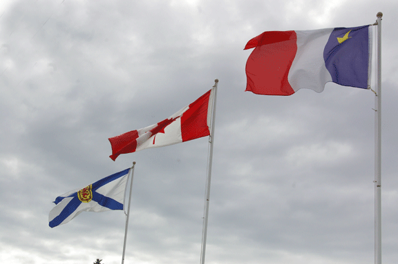
some of them remain in the Acadian region of Nova Scotia. They have their own flag, and everyone must
be very proud of their French heritage, because the all had Acadian flags
flying. Apparently, July 2 is Canada
Day. Need to look that one up to see if
it is just a national pride day or a holiday for another historic reason. For breakfast, our waitress was a lady with a
daughter named Catrina. She told us
about the local fishing industry and
mentioned that Pubnico is the largest lobster fishing wharf east of
Montreal. We drove down to the wharf to
see all of the fishing vessels at the docks.
We asked her advice on whether we should make the long drive to the far
end of Nova Scotia to see Cape Breton Island or if we should head north once we
reach Halifax and head back toward New Brunswick. She told us Cape Breton is beautiful, but
that with our time constraints, we might be best served by making the shorter
loop and seeing the cliffs on the New Brunswick side of the Bay of Fundy. Both ladies were so friendly and willing to
share their thoughts.


The drive from Pubnico to Lunenburg was nice, with some
pretty seascapes along the way, though if you stay on the larger highway (103),
you see only large trees lining both sides of the highway. When you venture off on highway 3, you see
much more and pass through a number of small fishing villages. It began to rain about mid-morning and
continued for an hour or two, a welcome
sight for West Texas travelers, but it did prevent us from stopping for more
than a quick photo op at a couple of beautiful beaches with waves crashing
against some of the rocks….very pretty scenery.


Next, we stopped in Lunenburg and parked next to the
Fisheries Museum to walk around for awhile looking at the boats and ships along
the waterfront. We went into a few small
shops before heading out to Mahone Bay, where we took pictures of these three
churches that are situated side by side along Edgewater Street. The first is an Anglican, the second is
Congregationalist , and the third is the Church of Canada. The pics are on my phone, so I'll add those when I can.
After leaving Mahone Bay, we headed on to Halifax, which is
the Metro area of Nova Scotia.
I have to admit we’ve been stumped by some of the road signs
that we’ve seen along the way. I need to
do some basic research to see what they all mean. It’s fun to make up explanations based on the
images, but that’s not really useful when you’re looking for a bathroom….I mean
“wash room”
In many ways, Halifax impressed me as your typical big city,
with busy streets and claustrophobic downtown areas. In fact, one street from the harbor, you
could convince yourself that you were in San Antonio, Texas or another
congested city center. But we went down
to the boardwalk that runs along the bay and spent some time in the Maritime
Naval Museum. Since Halifax is a major seaport and naval
base, the museum includes WWII battleships and early 1800s schooners that are
docked along the boardwalk. The museum
wasn’t open yet, and since it was
Sunday, the pier wasn’t all that crowded, so we walked to the far end to
a large indoor farmer’s market, which was very interesting and smelled of
coffees, fresh vegetables, and baked goods from a French pastry shop
inside. Back at the Maritime Museum, we
visited e exhibits, which included a history of the Halifax port and the area’s
role in both the shipping trade and fishing industries, as well as the role of
Nova Scotia in the major battles of different wars. The was also an interesting exhibit on the
1917 explosion that destroyed much of the harbor area and killed and wounded many sailors and
civilians when a munitions ship collided with a cargo ship carrying loads of
pure alcohol. Another major exhibit
chronicled the role that Halifax played after the Titanic sank in 1912. Halifax was the nearest port, so several ships were dispatched to aid in the search
for survivors and to transport the dead back to Halifax, where many of them
were buried.
7/7We spent the night across the bay, at the Best Western in Dartmouth, which is really part of Halifax, or so it seems. The hotel was in an industrial complex, so on this Sunday evening it was much quieter and calmer than downtown Halifax. We had an interesting escapade booking the room. We needed to find a wifi hotspot, so after some meandering, loopity-looping, and head scratching, we found a McDonalds where we could get online and search for a hotel. Unfortunately, my laptop battery died in the middle of booking the room, and the only plug in we could find was next to the entrance to the bathrooms. So, we pulled a chair over to the bathroom door without totally blocking it, logged on really quickly and booked the room. Ah…..such an adventure. =)
Leaving Halifax the next day, had lunch at Murphey’s Fish
and Chips in downtown Truro. The fried
Haddock was so fresh and nicely prepared that I even ate some, and the two waitresses
that we talked to were very friendly and told us about the area and what we
should try to see on our way. We drove
down the northern peninsula of Nova Scotia, on the opposite side of the Bay of
Fundy, and saw some of the prettiest areas yet, especially the seaside cliffs
at Cape D’Or. It was a steep walk down
to the lighthouse and cliff overlook, but well worth the effort. The views were amazing where the extreme
tidal variations have eroded the coast over the centuries and created an area
with rip tides that run parallel to the shore.
We spent the night at the Sunshine Inn in Parrsboro, which
is also on the Bay of Fundy. It was a
nice roadside hotel owned by a couple that we assumed from the accent were
French Canadian. They made breakfast for
us, with blueberry pancakes, sausage, and eggs.
They told us that they grow their own blueberries, so we asked if we
could walk down to the field behind the hotel to see them. We took the walk but couldn’t decide which
plants were the blueberries, which were raspberries, and which were just native
bushes and trees. It was really quite
comical, and Trina reminded me of the time that a family had car trouble near
our house in Snyder and asked to borrow the phone. A tumbleweed that had been gathering cotton
from a nearby field had made its way to our front yard, and the woman told her
kids, “Look guys! I’ve never seen a real
cotton bush up close before!” I didn’t
have the heart to expose her ignorance right there in front of her children,
and thankfully the Nova Scotia couple didn’t mock our ignorance of blueberry
vine/bushes/trees, or whatever they grow on. We’re enroute to Maine now, and
are still in pursuit of the illusive blueberry bushes that the area is so
famous for. I’m sure they are right in front
of our eyes and we’re just too dumb to see them. (Forest for the trees, and all that
nonsense)….


We’ve discovered that
they don’t have white gravy in this part of the world, and they even serve
brown gravy with chicken strips, biscuits, and French fries.
We left Nova Scotia the next day, and headed back toward New
Brunswick. We drove along the coast
again, only this time, the Bay of Fundy was called the “chocolate river”
because we were at the easternmost end of the bay, where the 17+ foot tidal
range was most dramatic. Areas that are
full of water at high tide, around 5am and 5pm, were emptied muddy basins at
low tide, around 11am and 11pm. It is
just so dramatic, and the wooden boats and fishing vessels what were floating
peacefully at high tide are now mired in the mud, protruding out of the bay
like beached whales. We stopped to see
the wonder of the Hopewell Rocks, which display the dramatic tidal shifts in an
amazing cove, where the “flowerpot rocks” and “diamond rock” tower hundreds of
feet above the beach, separated from the tall cliffs where the years of water
erosion have cut away at the coastline. At low tide, you can walk along the ocean
floor, and watch as the sea comes back into the bay, and by high tide, they
have everyone back up the four flights of steps leading down to the beach to
view the same sight from the observation decks, where the areas that were
filled with beach combers are now fully underwater. An amazing sight.
About 30 more miles down the road, we stopped for the night
at a cabin (challete) in the Fundy National Park. This is a beautiful area, with 100+ foot tall
pines, maples, and an assortment of other trees, and views of the dark blue
waters of the Bay. It’s amazing how, at
high tide, the chocolate colored water shifts to such a beautiful shade of
blue.
The next morning, we had biscuits and white gravy at the
cabin and had a nice breakfast before heading out toward St. John, then on to
the border crossing at St. Stephen/Calais.
We exchanged what we had left of Canadian money for good ol devaluated US
cash, and crossed the border fairly quickly.
We headed on down route 1 on the coast of Maine, retracing
our steps from the first leg of our trip to some degree. We stopped for a quick lunch at a little
diner near Dennysville called The Cobscook Bay Café. It was a converted two car garage that had
changed hands several times as a diner, and there was only one lady there
running the whole place. She was
efficient, though, and everyone enjoyed their the burgers, blts, and chicken salad wraps. We all agreed to rank it well above the meal
that we ate on the ferry from St. John to Digby on the second day of our
trip. That was a bit too much like
overpriced cafeteria food, from the odd-shaped chicken nuggets to the Captains
seafood platter, all of which we were sure were fried in the same grease. I think we would all recommend the ferry
ride, but not the lunch. A sack lunch
would have been much preferred if we had known in advance.
A few minutes after getting back on the road, we passed a
sign for the Quoddy Head Bay lighthouse.
It was a 15 mile detour, but we thought it might be worth it, and it
was. The red and white striped
lighthouse was probably the prettiest one that we saw to that point, with the
beautiful dark blue waters of the Maine Bay in the background. It is located near the town of Lubec, which
is the easternmost town in the U.S. It
sits on the U.S. Canadian border with a bridge connecting it to Campobello
Island, New Brunswick. When we left the
Cobscook Bay Café, we were about 98 miles from our destination in Bar Harbor,
but when we left the lighthouse, an hour or so later, we found out we were more
like 110 miles from Bar Harbor, meaning that we had backtracked considerably on
our detour. We were glad we did, though,
because we would have missed this beautiful sight otherwise.
Well, we finally figured out what blueberry fields look
like, and, wouldn’t you know it, we’ve been passing through them for days
unawares. They grow really close to the
ground, so to us they looked like close cropped fields of weeds. Now that we know, we’re seeing them
everywhere, of course. =) In Nova Scotia, they told us they would be
harvesting this year’s crop in 2-3 weeks, so we’re assuming (probably
incorrectly) that the same is true here in Northern Maine.
I'll add more pics tonight..... =)
No comments:
Post a Comment